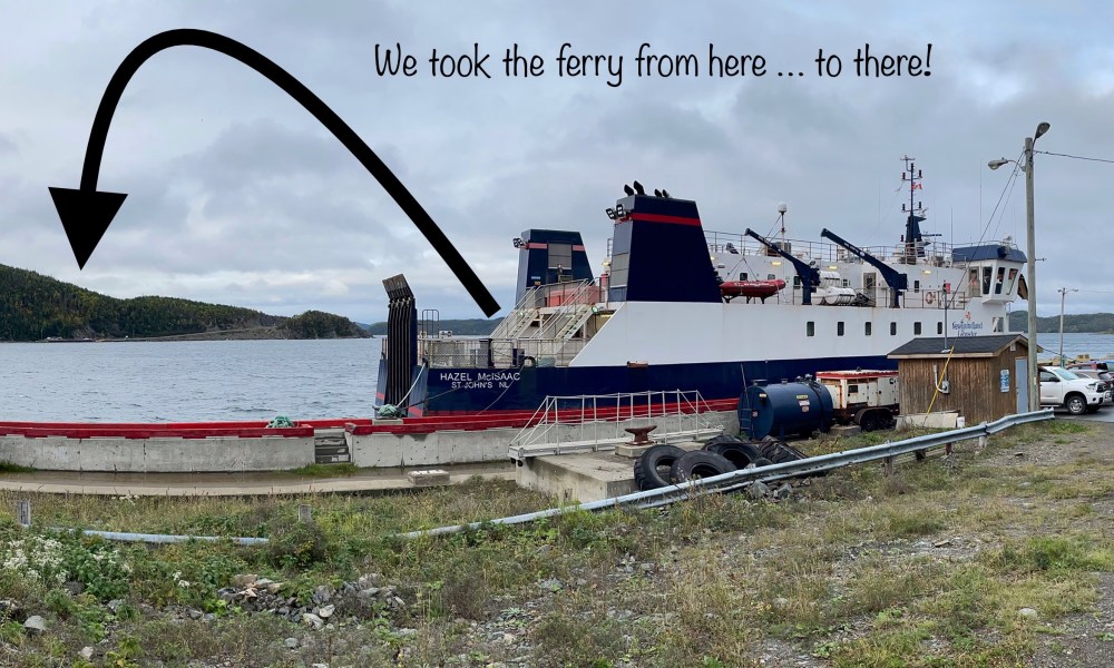
On October 5th I boarded the ferry at Pilley’s Island to make my way to Lushes Bight, Beaumont and Beaumont North in order to check off the last three places on my list. What list was this? A list to visit every place on the island of Newfoundland.
For many years I have travelled this province, long before pandemic staycations became a thing. I travelled for work, vacations, hiking excursions, girlfriend road-trips and solo ‘break from reality’ getaways. I travelled for the sake of travelling. In 2020 when the global pandemic hit I picked up my frayed, dog-eared Newfoundland and Labrador road map, held together with reams of scotch tape, with the highlighted places I have been, and decided “why not finish this!” So that is exactly what I did. For the past 18 months I gallivanted from one corner of the province to the other until I reached my last stop, here.
THE FERRY
GETTING HERE
Pilley’s Island – Long Island
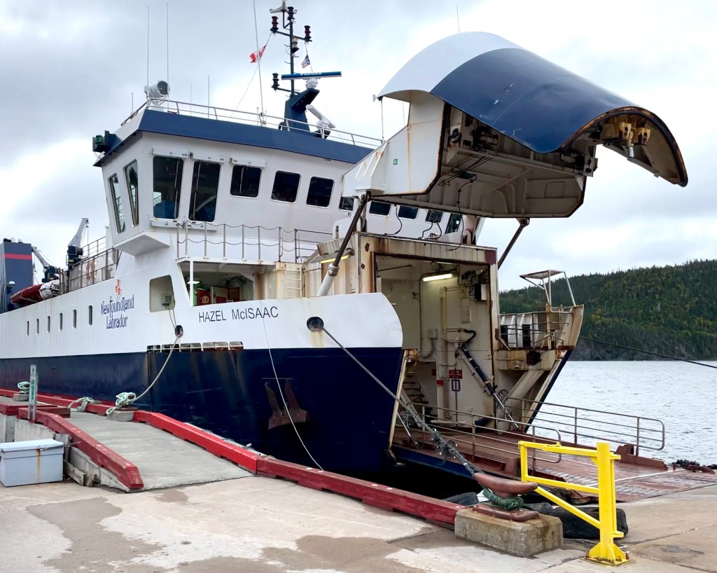
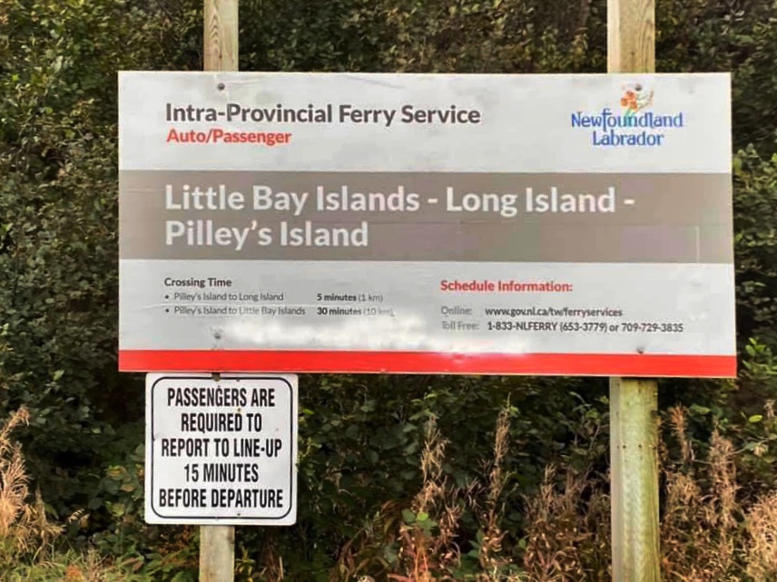
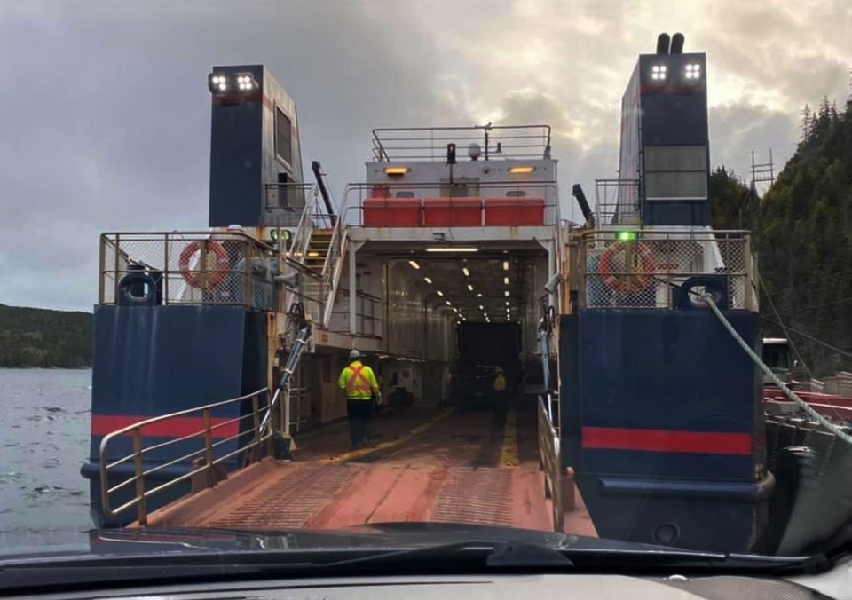
The MV Hazel McIsaac is the drive-on/drive-off passenger/vehicle ferry that operates the daily run from Pilley’s Island to Long Island. To get there you will take Route 380 north from the Trans Canada Highway at South Brook, for about 40 kilometres. The ferry has a carrying capacity of 80 passengers and 16 vehicles and you pay your fare on the Long Island side for a ‘return trip’. The distance between the two islands is a mere 1km and it takes less than 5 minutes to cross!
For many years, the Hazel McIsaac also serviced Little Bay Islands, a neighbouring island 10kms away, but in November 2019, fifty-five of its residents chose permanent resettlement. Only two people remain in Little Bay Islands, a couple choosing to live off the grid.
Schedule Information: 1-833-653-3779 or 709-729-3835
Crossing Time:
Pilley’s Island to Long Island (1 km): 5 Minutes
https://www.gov.nl.ca/ti/ferryservices/schedules/f-lbisa/

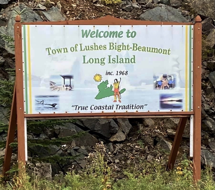
THE COMMUNITIES
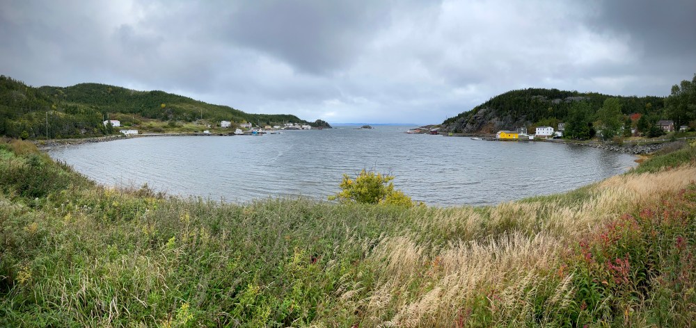
Long Island has three communities connected by 9 kms of paved road: Lushes Bight, Beaumont and Beaumont North. There are approximately 230 people living on the island.
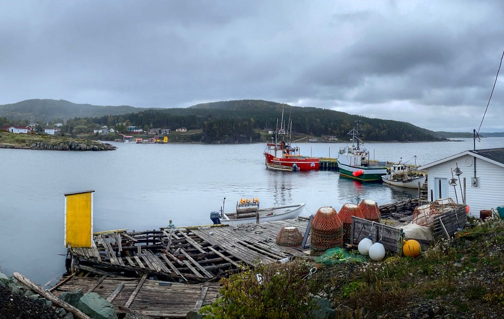
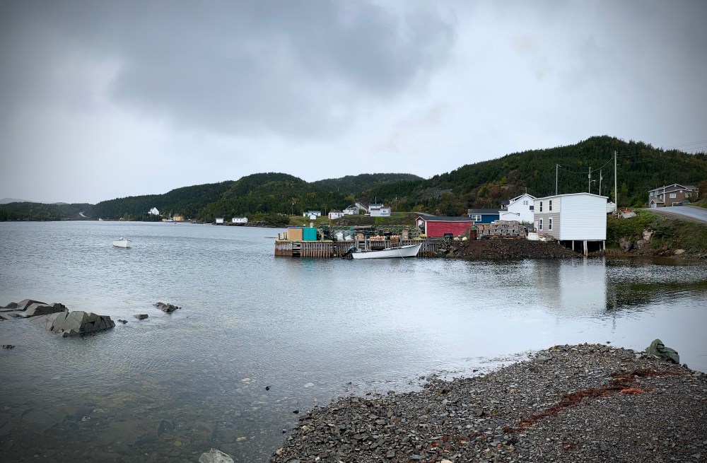
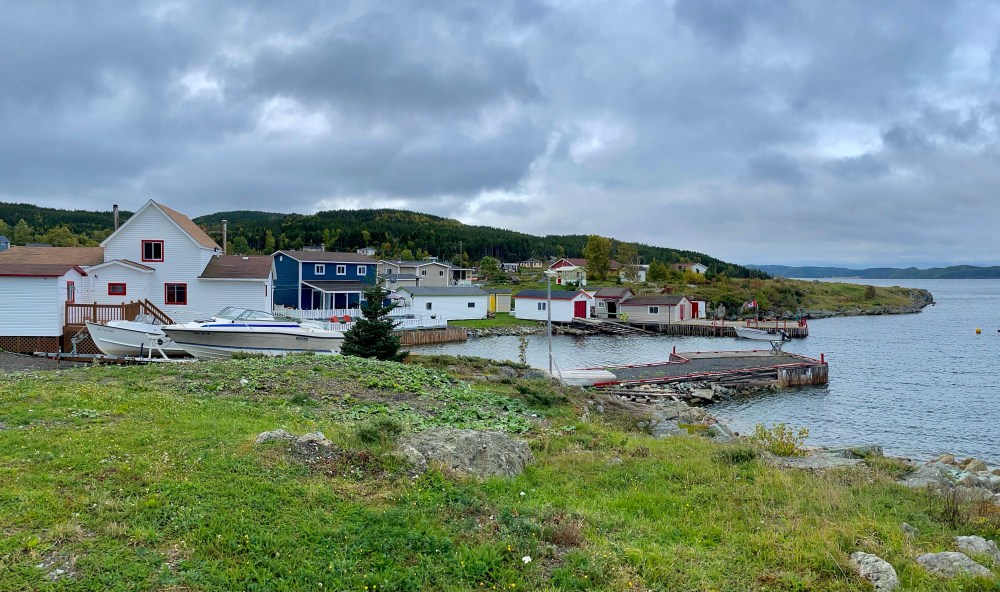
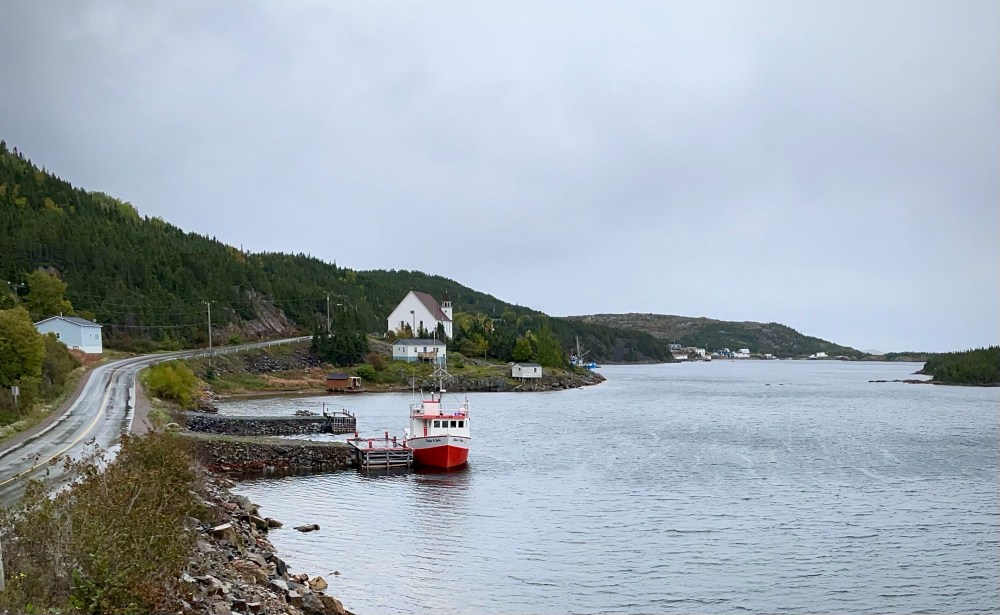
When you disembark the ferry you are met with an all-white lighthouse, a set of bright neon green chairs and a welcoming community sign which depicts the Beothuk people who once frequented these shores. On the drive you see an ever changing palate of colour, with fish stages and sheds painted the brightest of blues, greens, yellows and reds, creating contrast against a sometimes dreary, fog-draped coastline. Vegetable gardens can also be seen scattered throughout the rugged landscape. My favourite being a garden guarded by a lady scarecrow dressed in her finery while donning a Covid facial mask, the gardener’s way of offering up some much needed humor during these uncertain times. Another notable mention is the passel of Canadian flags that fly proudly from homes, flagpoles and fishing wharfs. My impression is that these Long Islanders take their national holiday pretty seriously and one can only imagine that Canada Day celebrations here must be a riot! Overall, this is a beautiful island that wears its past and present with evident pride.

The Long Island Heritage Centre and Tea Room, unfortunately, was closed for the season when I stopped by for a look. This property, a co-operative general store from 1957 to 2002, provided goods needed for the salt cod and lobster fishery as well as other staples like groceries, clothing, and hardware. In 2007 it was given to the Town of Lushes Bight – Beaumont and was designated a Municipal Heritage Site. The building maintains much of its original charm and displays artifacts and crafts contributed by Long Island residents. The outdoor space includes a gazebo, boardwalk and tables and chairs, if you feel so inclined to sit and take in the fresh salty air and ocean views.


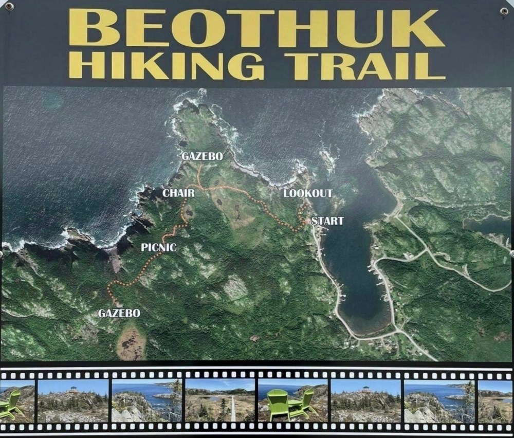
The Beothuk Hiking Trail is a moderate 3.7km linear trail located in Beaumont North. It is so named because this area was heavily frequented by the indigenous Beothuk people. The trail has wooden boardwalks that cross over marshlands and gazebos that overlook several headlands and islands. The weather was uncertain when I pulled up to the trailhead so it was decided to leave it for another day.
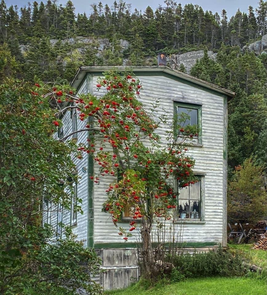
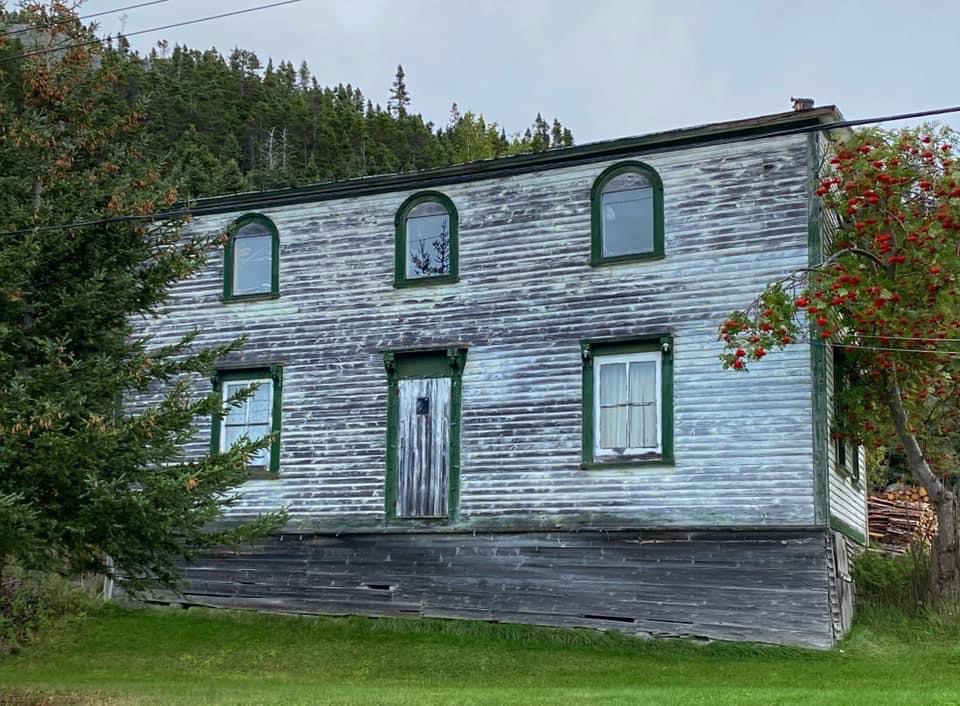
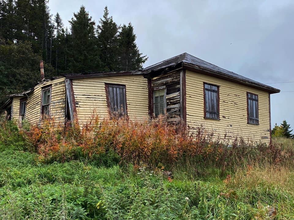
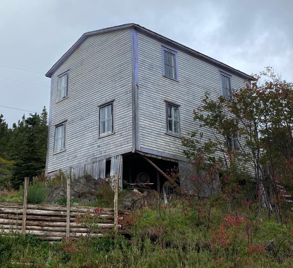
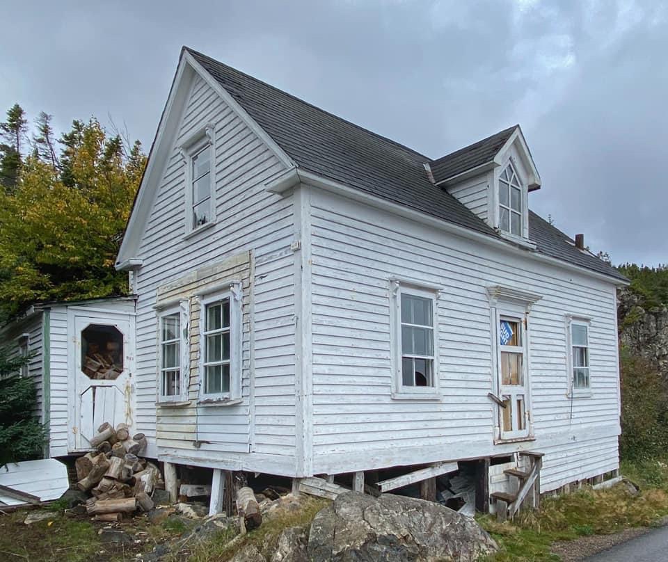
OLD HOUSES
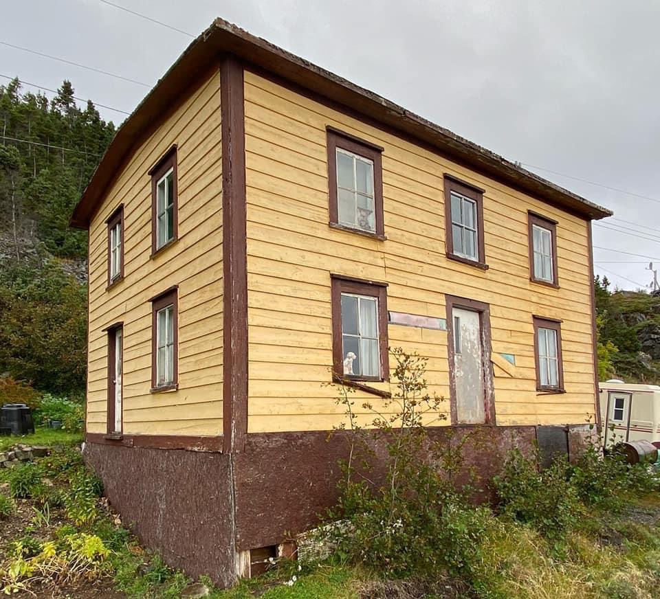
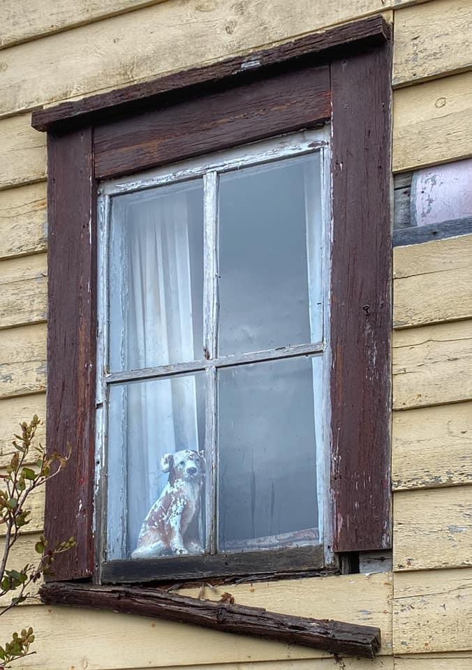
If you like to photograph old abandoned houses, as I do, you won’t have to travel far to see them. Nestled in the hills overlooking the ocean, traditional Newfoundland biscuit box houses remain, uninhabited and unchanged. The wood siding and trim on some still have lasting colour, while others appear weather-beaten and worn, surrendered to unforgiving elements of weather and time. While photographing these houses I couldn’t help imagine the stories their walls could tell. If you really think about it, there are hundreds, if not thousands, of abandoned homes on the island of Newfoundland, treasures that will never again feel the warmth of the wood burning stove or the laughter of children as they peek down through the cast iron floor grates to eavesdrop on conversations below.
A gentlemen did approached me while I was trying to capture the essence of the small, white house with its tiny, single dormer and said “make an offer and it’s all yours!”, to which I sadly responded “if I’d didn’t live so far away sir, I certainly would”.
LEAVING LONG ISLAND
My time here on Long Island was short, as I was eager to return home to St. John’s before tropical storm Sam arrived. Upon landing at the ferry terminal back on Pilley’s Island I couldn’t help but look at where I was and where I had been just minutes before. Questions from a previous visit to Pilley’s Island resurfaced in my mind, “how is it possible there is a ferry that goes from here, to there?” and “why isn’t there a causeway to the mainland given the Hazel McIsaac no longer has to accommodate Little Bay Islands?” One would think the long term benefits of a fixed link would certainly outweigh the operating cost to the Provincial Government and would be an economic advantage for the people who live here, not to mention those that have left and wish to return. I have no personal stake in this controversy, so my opinion matters naught. I am not the first person to ponder this conundrum, and certainly won’t be the last. All I can say is, you have to see it to believe it!

WOW Interesting yo this Newfie.
LikeLike
so glad you were able to visit our piece of paradise…I grew up here, moved to Ontario right after high school, retired early, and moved back 3 years ago. It truly is a special place 💖
LikeLike
Wonderful post, which I hope to use as a guide to kayak the area. Do you have any suggestions on visiting Pilley’s and Long islands with a kayak (camping spots, unusual currents, launching places, etc.)?
The Notre Dame Bay coastline seems to be an endless surprise and too long for a whole lifetime. I hope the Long Island shore will have some areas a bit less wild than the waves outside of La Scie!
On another note, have your boots been on the East Coast Trail? Any sections you would particularly recommend? Judging from what I have hiked along the Appalachian Trail (which at one point in Maine is broken by a large river with a fast current and no way to cross), I suspect that topography and everything else on the ECT vary unpredictably.
LikeLike
Hello,
Thank you for your kind comments. Though I am from Newfoundland, I am not from this area. Regarding kayaking to Long Island, I have no recommendations or advice to offer as I do not ocean kayak. Newfoundland’s coastline is vast and there are countless islands around our shores, our weather can often be unpredictable as well. I am recommending that you directly contact the Town Council of Long Island, Lushes Bight and Beaumont for details, here is the email address on their town page: beaumont@xplornet.ca , also they have a Facebook page: https://www.facebook.com/people/Long-Island-Town-of-Lushes-Bight-Beaumont/100064320294590/ .
Regarding the East Coast Trail, yes I have done it, one trail at a time, not all at once! There is an East Coast Trail website and Facebook Page as well and I would suggest you follow/join. We do get thru-hikers every year but that takes it to a whole new level of planning. Good Luck!
LikeLike